Illustrious career surveying the lie of the land
8 March 2018
If you've spent time enjoying any of the country's picturesque regional or national parks over summer then Bill Robertson will be delighted.

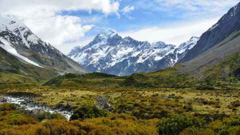
The world-renowned figure in surveying and mapping was instrumental in establishing many of New Zealand’s coastal reserves and National Parks. These tasks saw him travel the length of the country in the 1970s, to identify and recommend areas to be set aside for protection. He was also the first planner for the Hauraki Gulf Maritime Park on its establishment in 1968. These are just a few of his many achievements in a long and esteemed career.
In recognition, on Friday night, William (Bill) Robertson ONZM will be honoured with a 2018 Distinguished Alumni Award from the University of Auckland.
I loved being outdoors and it kept me fit.
The Awards, held annually, honour University alumni who have made outstanding contributions to their professions, their communities, to their nation and beyond.
Born in Temuka in 1937, Bill moved to Marlborough as a child where he attended Pine Valley Primary, a nine pupil school. His academic progress was he admits ‘a bit mixed.’ During the fifth form he looked for a job in the public sector where he was advised to sign up as a Lands and Survey’s draughting cadet. From there he was appointed a survey cadet and moved to surveying and a life which has taken him all around New Zealand as well as to places as varied as Antarctica and Eritrea.
“When I first started out my work entailed tramping up to the top of lots of mountain carrying 40 pounds of equipment. I loved being outdoors and it kept me fit,” he says.
His extensive experience eventually led him to serving as director general/surveyor general of the NZ Government Department of Survey and Land Information for nine years. His term was during the challenging economic and environmental restructuring of the late 1980s and early 1990s.
At this time, a large department of some 1400 staff was transformed by management and staff from a traditional free government department service, into a responsive high technology one. Under his leadership it achieved the cost recovery of three quarters of its budget through a huge increase in revenue and cost control, but without staff redundancies.
More recently he has practiced as an independent consultant and served as a consultant for NZAID, AusAID, World Bank, Food and Agricultural Organisation to name a few, plus worked on land administration and management projects in Vanuatu, Zimbabwe, Pakistan, Cambodia, Philippines, China, Albania, Thailand Australia and New Zealand.
Bill has also used his expertise to help determine disputed international borders. He served as a UN Commissioner on the Iraq/Kuwait Boundary Demarcation Commission in 1991-1993, as a Special Consultant to the Eritrea/Ethiopia Boundary Commission, 2001-2007, a senior consultant to the Cameroon/Nigeria Mixed Commission, 2003-present, and as an Independent Expert for the Sudan Tribunal, 2009.
Of Ngai Tahu descent, Bill has a strong interest in indigenous land issues. While Chairman of the New Zealand Geographic Board he organised the production of ‘A Maori Oral History Atlas’ featuring maps of Maori settlement and place names throughout the North and South Islands and Rakiura.
“Surveying in New Zealand began with the first Polynesian navigators, explorers and settlers,” he says. The earliest record we have is of Kupe visiting over 1000 years ago. The original surveys existed as oral information and it’s important we acknowledge this.”
In 2009 he was made an Officer of the New Zealand Order of Merit for services to surveying.
He is a NZ Registered Professional surveyor and Fellow of the NZ Institute of Surveyors and a Fellow of the NZ Planning Institute of which he is a past president. He is also a former president of the Commonwealth Association of Planners. He is a foundation member of the Surveying and Spatial Sciences Institute of Australia and an Eminent Person of Australasian Urban & Regional Information Systems Association (AURISA).
He is an Honorary Fellow Otago University and holds a Diploma in Town Planning (Auckland) Master of Public Policy (Victoria) and Honorary Doctorate in Surveying (Melbourne). He is a past Chairman of NZ Aerial Mapping, Aspect North Lismore, NSW, and Chairman of Terralink International Limited.
Bill's contribution to surveying has been considerable – a mountain in Antarctica bears his name in acknowledgement of his work there - and he continues to play an active role in the industry.
Deputy-Vice Chancellor (Strategic Engagement) Professor Jenny Dixon says Bill Robertson’s work has reached into the everyday lives of many New Zealanders without them knowing.
"During his illustrious career as a senior public servant he marshalled the disciplines of planning and surveying with real-life impact. He made a major contribution to the theory and practice of regional resource planning. We are delighted to honour him with a Distinguished Alumni Award,” she says.
For more information about the Distinguished Alumni Awards visit https://www.auckland.ac.nz/daa
Media queries
Miranda Playfair | Media adviser
M: 021 063 8393
E: m.playfair@auckland.ac.nz