We need to re-think our volcanic hazard maps – new study
11 April 2019
The deadly cloud of gases, ash and rock particles emitted by an erupting volcano could spread much further than previously thought.

The deadly cloud of gases, ash and rock particles most commonly associated with historic eruption sites such as Pompeii could spread much further from a volcano than previously thought, a School of Environment study shows.
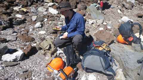
PhD candidate Geoffrey Lerner and Professor Shane Cronin focused their latest research project on Mt Taranaki where they found evidence of these lethal ‘pyroclastic flows’ 10km further from the mountain than previous studies had shown – up to 25km away at some points.
That puts populated areas of Taranaki at much higher risk during a significant and ongoing eruption, affecting not just Egmont National Park and farmland but all major towns within the region.
Mt Taranaki has been dormant for one of the longest periods of the last 1000 years – it last erupted in 1790AD and has a 50% probability of erupting again in the next 50 years. In the study, rocks sampled 15km-25km from the mountain could be linked to one of the largest eruptions at Mt Taranaki.
An event of that size would have potentially devastating effects.
“The pyroclastic flow deposits we studied came from one of the largest Taranaki eruptions of the past 30,000 years, an event that is estimated to happen on average once every 1000 years,” Geoff says. “At 25km from the volcano, hot pyroclastic flows from an eruption of that magnitude would affect all major towns in Taranaki and pose a much greater threat to people’s lives.
“A recent estimate of net losses in economic activity from even a brief Mt Taranaki eruption is at more than a billion dollars but if an eruption continued for a long period of time, the effects would be on a national scale, disrupting air transport, farming, tourism and power and water supplies.”
This latest work, done in collaboration with Dr Gillian Turner from Victoria University Wellington and published in the Geological Society of America Bulletin, used a novel paleomagnetic method to better understand the distance of hot pyroclastic flows by checking if magnetical particles within rocks “lined up”. Because rocks cool as they erupt from a volcano, they record a signal from the Earth’s magnetic field which includes strength and direction and this can be measured to identify rocks from pyroclastic flows.
“This technique has lots of potential for other volcanoes such at Mt Ruapehu but we also hope by publishing this work, other scientists will be inspired to re-examine their geological record and hazard outlook for volcanoes around the world,” says Geoff.
Professor Cronin says one upshot from this study is working towards more urgent research into long and complex eruption episodes at Mt Taranaki and, using novel integration of advanced mathematical and economic modelling, aim to radically reduce uncertainty in planning for an ongoing volcanic event.
“The hazard and risk management strategy in New Zealand is focused on isolated and finite events but our approach addresses the question of what if a hazard event doesn’t stop?
“We need the adaptive capacity for long-term hazard mitigation or, to put it bluntly, we need to take another look at our hazard maps.”
Media contact
Anne Beston | Media adviser
DDI 09 923 3280
Mob 021 970 089
Email a.beston@auckland.ac.nz